Friday, October 18, 2024
Fuerteventura Travel Guide - Travel S Helper

Fuerteventura

travel guide

[lwptoc]

Fuerteventura (literally “strong fortune,” although others read it as “Strong Winds” or a translation of the French phrase for “Great Adventure”) is one of the Canary Islands, located in the Atlantic Ocean off the coast of Africa. It is officially part of Spain. It is the second biggest of the Canary Islands, after Tenerife, with an area of 1,660 square kilometers (641 square miles). In May 2009, UNESCO designated it as a biosphere reserve. Puerto del Rosario is its capital.

In 1965, the first tourist hotel was erected, followed by the building of Fuerteventura Airport at El Matorral, ushering in a new age for the island. Fuerteventura, with its 3,000 sunny hours per year, has firmly established itself as a significant European vacation destination. Despite having fully established tourist amenities, the island has avoided the overdevelopment seen on some other islands, and hence caters to travelers drawn by its rough natural beauty.

The summer Trade Winds and winter Atlantic swells make this a year-round surfers’ paradise, with more exposed areas on the north and west shores, such as Corralejo and El Cotillo, being particularly popular. Wind surfing is practiced at many areas along the island. Sailors, scuba divers, and big-game anglers are all lured to these brilliant blue Atlantic seas, which are frequented by whales, dolphins, marlin, and turtles. Hikers are drawn to this island because of the various hills that dot the landscape.

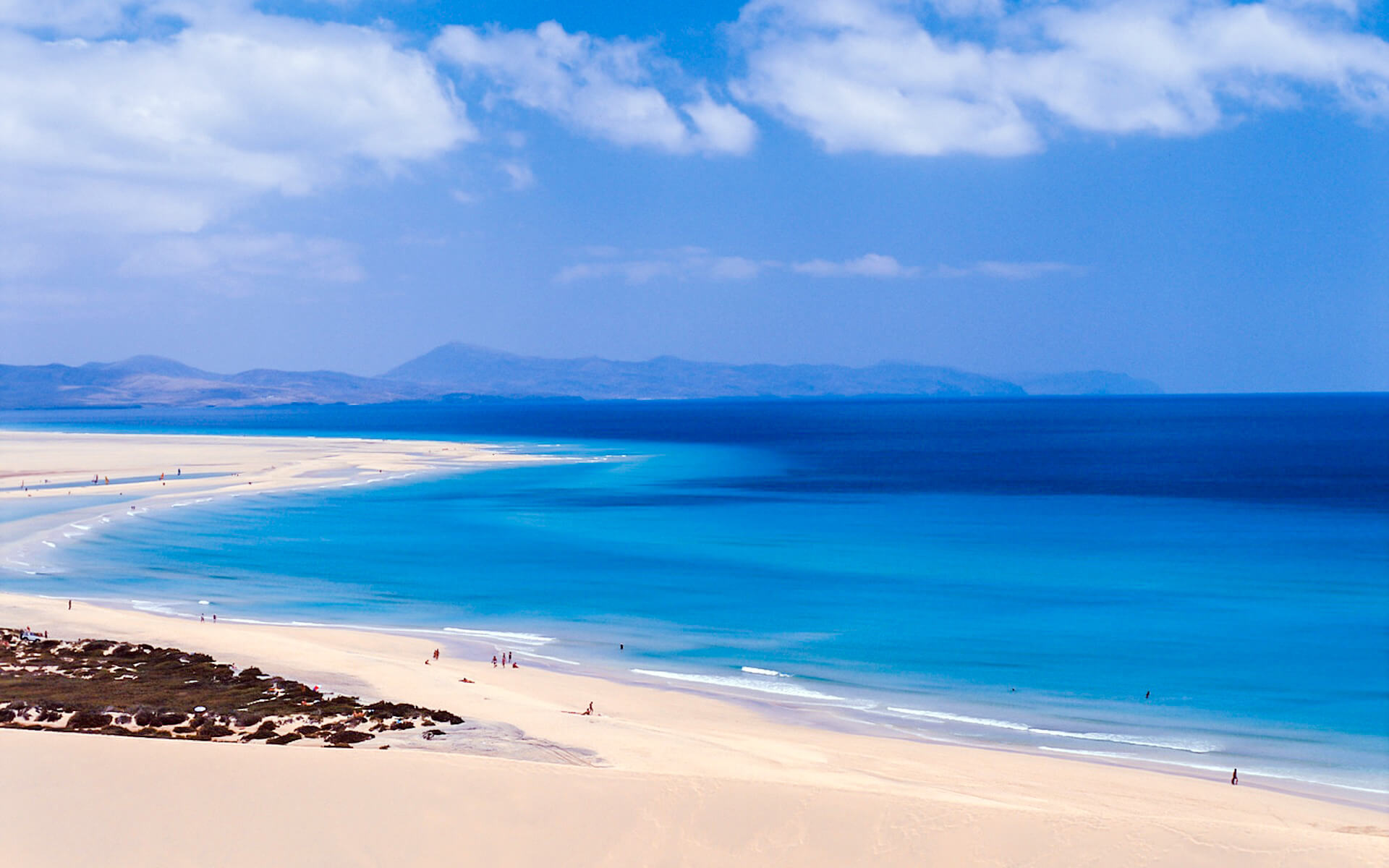
Many areas have beautiful sandy beaches. Strong surf may be expected on western beaches, such as those around El Cotillo. Popular beaches include those next to the huge sand dunes east of Corralejo, as well as the more sheltered broad sandy shoreline of the Playa de Sotavento de Jandia on the southeastern coast between Costa Calma and the Morro Jable. Naked sunbathing and swimming are practically universal on all beaches.

Much of the interior, with its vast plains, lavascapes, and volcanic mountains, is protected, however organized excursions and car access are available.

Flights & Hotels
search and compare

We compare room prices from 120 different hotel booking services (including Booking.com, Agoda, Hotel.com and others), enabling you to pick the most affordable offers that are not even listed on each service separately.

100% Best Price

The price for one and the same room can differ depending on the website you are using. Price comparison enables finding the best offer. Also, sometimes the same room can have a different availability status in another system.

No charge & No Fees

We don’t charge any commissions or extra fees from our customers and we cooperate only with proven and reliable companies.

Ratings and Reviews

We use TrustYou™, the smart semantic analysis system, to gather reviews from many booking services (including Booking.com, Agoda, Hotel.com and others), and calculate ratings based on all the reviews available online.

Discounts and Offers

We search for destinations through a large booking services database. This way we find the best discounts and offer them to you.

Fuerteventura | Introduction

Climate of Fuerteventura

The weather in Fuerteventura is lovely all year. The island is also known as the “Island of Eternal Spring.” The water cools the air, causing the scorching Sahara winds to blow away from the island. The English translation of the island’s name is “strong fortune” or “strong wind,” with viento being the Spanish word for wind. During the winter, temperatures average a high of 22 °C (72 °F) and a low of roughly 15 °C (59 °F), while in the summer, temperatures average a high of 28 °C (82 °F) and a low of 20 °C (68 °F). Precipitation averages 147 mm (6 in) per year, with the majority falling in the autumn and winter. The month with the most rain is October.

The Calima sandstorm (similar to the Sirocco wind, which blows south from the Sahara into Europe) comes northeast from the Sahara Desert, causing high temperatures, reduced visibility, and drying air. Temperatures increase by around 10 degrees Celsius during this event. The wind blows on fine white sand, and visibility may dip to 100 to 200 m (328.08 to 656.17 ft) or lower, bringing African locusts to the island.

Geography of Fuerteventura

The island’s total size is 1,660 km2 (641 sq mi). The island is 100 kilometers (62 miles) in length and 31 kilometers (19 miles) in width. It is under the jurisdiction of the province of Las Palmas. It is split into six municipalities, which are as follows:

  • Antigua
  • Betancuria
  • La Oliva
  • Pájara
  • Puerto del Rosario
  • Tuineje

These municipalities are responsible for the distribution of 100 separate villages. Islote de Lobos, a neighboring islet, is part of the municipality of La Oliva.

It is the second largest island in the archipelago, after Tenerife, and boasts the longest beaches in the archipelago. It is located barely 100 kilometers (62 miles) off the coast of north Africa. The island is a popular location for sunbathers, beachgoers, and watersports aficionados. It is located in the same latitude as Florida and Mexico, and temperatures seldom drop below 18 °C (64 °F) or climb over 32 °C (90 °F). There are 152 beaches along the coastline, with 50 kilometers (31 miles) of fine white sand and 25 kilometers (16 miles) of black volcanic shingle.

Economy of Fuerteventura

Fuerteventura’s economy is mostly reliant on tourism. The main tourist destinations are centered on the existing settlements of Corralejo in the north and Morro Jable in Jandia, as well as the exclusively tourism development of Caleta de Fuste south of Puerto del Rosario. Fisheries and agriculture are two more important sectors (cereals and vegetables). Majorero cheese is manufactured in the region from the milk of the indigenous majorera goat.

Fuerteventura had the highest EU regional unemployment rate at a NUTS3 level in 2009, at 29.2 percent.

Asia

Africa

South America

Europe

North America

Read Next

Bristol

Bristol is a city, unitary authority area, and county in the South West of England, having a population of 442,500 people in 2015. It...

Batumi

Batumi is Georgia’s second biggest city, situated on the Black Sea coast in the country’s southwest. Batumi, located in a subtropical zone near the...

Bologna

Bologna is the biggest city (and capital) in Italy’s Emilia-Romagna Region. It is the seventh most populous city in Italy, lying in the centre...

South Africa

South Africa, formally known as the Republic of South Africa (RSA), is Africa’s southernmost country. It is surrounded on the south by 2,798 kilometers...

Palanga

Palanga is a coastal tourist town on the Baltic Sea coast in western Lithuania. It is Lithuania’s busiest summer resort, with sand beaches (18...

Sierra Leone

Sierra Leone, formally the Republic of Sierra Leone, is a West African country. It is bounded on the north by Guinea, on the south...