
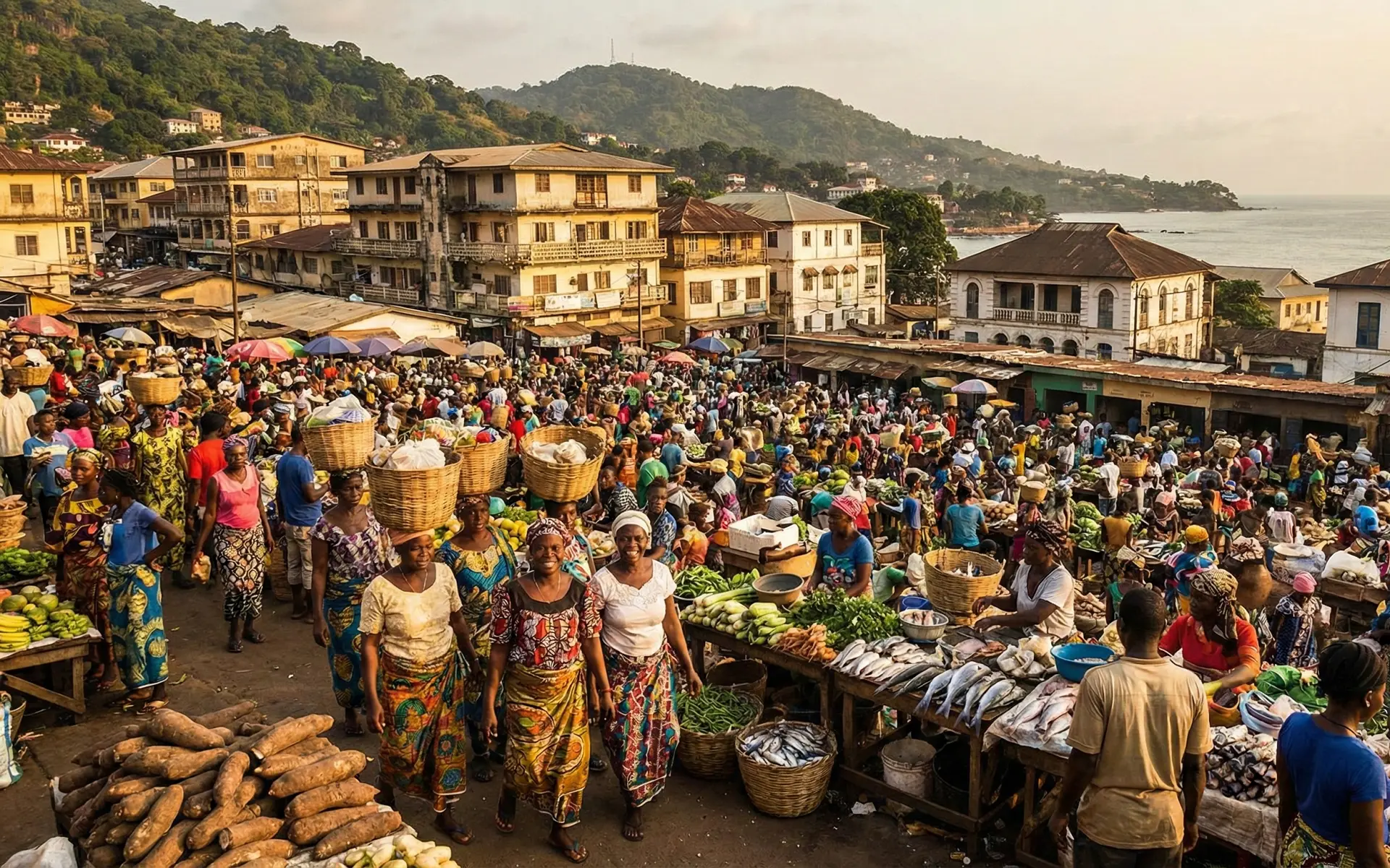

Sierra Leone covers 71,740 square kilometres on the Upper Guinea coast of West Africa, with Guinea around its north and northeast, Liberia along the southeast, and the Atlantic Ocean to the west and southwest. Freetown, the capital, occupies a steep peninsula beside the broad Sierra Leone River estuary, while the deeply indented coast includes beaches, tidal creeks, mangrove swamps, estuaries and islands such as Sherbro. Inland, low coastal plains rise into rolling plateaus and then more rugged highlands near the Guinean frontier. The Loma Mountains contain Mount Bintumani, or Loma Mansa, the country’s highest point at about 1,948 metres; the Tingi Hills form another important upland block farther east. Major rivers, including the Great Scarcies, Little Scarcies, Rokel, Sewa, Moa and Mano systems, generally drain southwestward to the Atlantic. This relief creates marked contrasts between maritime lowlands, cultivated interior plains and forested mountain watersheds.
Climate follows the seasonal movement of the West African monsoon and Intertropical Convergence Zone rather than a single uniform tropical pattern. The rainy season generally runs from May to November, with July and August usually wettest, while December to April is markedly drier and can bring dust-laden Harmattan winds from the northeast. Rainfall is exceptionally heavy along the coast, where national adaptation documents cite roughly 3,000–5,000 millimetres a year, declining inland toward about 2,000–2,500 millimetres in parts of the eastern and northeastern interior. Temperatures remain warm throughout the year, but elevation, cloud cover, sea breezes and seasonal humidity create local differences. The same rainfall that supports dense vegetation and rice cultivation also contributes to river flooding, road disruption and slope instability. Freetown is particularly exposed because steep, heavily settled hills descend toward low-lying coastal districts. Longer-term risks include coastal erosion, saltwater intrusion, stronger flood impacts and sea-level rise, while land clearance can intensify runoff and landslide hazards.
These climatic gradients support a mosaic of Upper Guinean rainforest, secondary forest, wooded savanna, farm bush, freshwater wetlands and extensive coastal mangroves. World Bank data placed forest area at about 34.3% of land in 2023, though that broad category includes landscapes of very different ecological quality. In 2025 UNESCO inscribed the 71,203-hectare Gola-Tiwai Complex, combining Gola Rainforest National Park and Tiwai Island Wildlife Sanctuary, as Sierra Leone’s first World Heritage property. It protects part of the Upper Guinean Forest hotspot and habitat for pygmy hippopotamus, forest elephant, western chimpanzee and hundreds of bird species. Most rural livelihoods depend on managed landscapes: rice is the principal staple crop, with cassava, oil palm and vegetables widely grown, while cocoa and coffee are important export crops. Rain-fed smallholder farming and swamp rice systems tie food security closely to rainfall, roads and soil condition.
Human settlement in the territory long predates written European accounts, but the region was historically organized mainly through chiefdoms, trading communities and shifting alliances rather than a state corresponding to modern Sierra Leone. Coastal and interior societies included ancestors of the Limba, Bullom, Temne, Loko, Sherbro, Kissi and other communities, while Mande-speaking movements from the interior reshaped parts of the country over centuries. Sixteenth-century Mane incursions were especially consequential in the south and east, contributing to new political and cultural formations, although historians differ over their exact routes and scale. Portuguese navigators reached the coast in the fifteenth century and applied the name Serra Leoa to the mountainous Freetown Peninsula. European trade later expanded around estuaries and islands, including Bunce Island, which became an important British-linked slave-trading station from the late seventeenth century. After Britain abolished its slave trade, an antislavery settlement began in 1787, Freetown was re-established in 1792 by Black settlers from Nova Scotia, and liberated Africans later added further linguistic and cultural layers to the emerging Krio community.
Britain made Freetown and its surrounding settlements a Crown Colony in 1808, while most of the interior remained under African rulers until the late nineteenth century. The declaration of a British Protectorate over the hinterland in 1896 created a lasting institutional divide between the colony and the provinces, where colonial administration relied heavily on paramount chiefs and indirect rule. The Hut Tax War of 1898, associated in the north with Bai Bureh and resistance elsewhere, showed that the new fiscal and political order was imposed through coercion. Nationalist politics expanded after the Second World War, and Sierra Leone became independent on 27 April 1961, initially as a Commonwealth realm, before becoming a republic in 1971. A one-party system was formalized in 1978. Multiparty constitutional government returned in 1991, the same year the Revolutionary United Front insurgency began. The civil war devastated communities and infrastructure until 2002; British intervention, regional forces and UNAMSIL helped reverse rebel advances, and by early 2002 more than 75,000 ex-combatants had been disarmed. Postwar governments have since operated within a presidential, multiparty constitutional system, although institutional trust and electoral accountability remain important political issues.
The modern economy combines smallholder agriculture, urban services and a mineral sector whose cycles strongly influence growth, exports and public revenue. Sierra Leone produces iron ore, diamonds, rutile, bauxite and gold, while cocoa is the leading agricultural export and coffee remains commercially important. Mining can lift headline GDP rapidly without creating employment on the same scale as farming and informal services, helping explain why macroeconomic recovery does not automatically produce broad household gains. Statistics Sierra Leone recorded real GDP growth of 4.4% in 2024; the IMF’s June 2026 review estimated 5.0% growth in 2025 and projected 4.0% in 2026. Inflation, after falling sharply during 2025, rose to 14.77% year on year in June 2026. Export earnings have recently been supported by cocoa and iron ore, but the country still imports large quantities of fuel, machinery, manufactures and food. China is an important commercial partner, while trade with Guinea and Liberia includes substantial informal flows. High debt-distress risk, limited domestic revenue and dependence on primary commodities constrain diversification.
Sierra Leone’s latest completed official population count is the 2021 Mid-Term Population and Housing Census, which recorded 7,548,702 people; this was well below the 8.49 million national medium-variant projection published for 2022, illustrating the difference between census enumeration and demographic projection. United Nations estimates place the 2025 population at about 8.82 million. Settlement is densest in the Western Area around Freetown and along principal road and trading corridors, while the northern highlands and parts of the forested east are more sparsely populated. World Bank data based on UN urbanization estimates put the urban share at about 46% in 2025, with Freetown by far the dominant metropolitan centre. Bo is the leading southern city, Kenema anchors the east, Makeni serves the north, and Koidu is closely tied to the diamond-producing Kono area. Administratively, the country consists of four provinces—Eastern, Northern, North Western and Southern—plus the Western Area, together divided into 16 districts. Local councils coexist with chiefdom governance across much of the provinces.
English is the official language of government, formal education and national law, but everyday communication is much more multilingual. Krio, an English-lexifier creole rooted in the history of Freetown’s settler and liberated-African communities, functions as the broadest lingua franca. Temne is especially important in the north and northwest, while Mende predominates across much of the south and east; Limba, Kono, Kuranko, Fula, Loko, Susu, Kissi, Sherbro and other languages remain significant within their communities. Islam is the majority religion, with government estimates commonly placing Muslims at about 77% and Christians at about 22%, while traditional religious ideas and practices can overlap with both. Sierra Leone is notable for institutionalized Muslim-Christian cooperation, including the Inter-Religious Council. Cultural life reflects these layered histories: Krio architecture and church traditions in Freetown, Mende and Temne social institutions, gara resist-dyed textiles, oral performance, palm-wine music and contemporary popular styles developed through exchange among coastal, interior and diaspora communities.
Transport remains road-based, so road condition directly affects food prices, rural market access and mining and agricultural costs. Trunk routes link Freetown with Makeni and Guinea to the north and Bo, Kenema and Liberia to the southeast, while feeder-road quality and rainy-season reliability remain uneven. The Port of Freetown at Queen Elizabeth II Quay is the main cargo and container gateway, and specialized mineral infrastructure includes the Pepel corridor. Freetown International Airport is at Lungi across the estuary; access uses marine transfers or the longer road route. There is no nationwide passenger railway, and surviving rail primarily serves mining. World Bank data put electricity access at 39.2% of the population in 2024. The grid relies on the 50 MW Bumbuna hydropower plant, oil-fired generation and imports through the Côte d’Ivoire–Liberia–Sierra Leone–Guinea interconnector. Heavy-fuel-oil producers still supplied 48% of utility purchases in 2024, showing the cost of fuel dependence and the case for cheaper generation and wider transmission.
Sierra Leone’s regional importance rests on its position between Guinea and Liberia, its Atlantic port, resource base and role in institutions linking the Upper Guinea coast. It belongs to ECOWAS, the African Union, the Commonwealth, the World Trade Organization and the African Continental Free Trade Area; Freetown also hosts the Mano River Union secretariat for Sierra Leone, Liberia, Guinea and Côte d’Ivoire. Its 2024–2025 term on the UN Security Council gave it a diplomatic platform informed by post-conflict state-building. Medium-term progress depends on turning resource exports and regional infrastructure into higher productivity through reliable electricity, better feeder roads, value-added agriculture, stronger public finances and jobs for a young population. Debt risk, import dependence, climate exposure, urban pressure in Freetown and uneven state capacity constrain that agenda, while regional power trading and cross-border corridors offer practical gains. Sierra Leone’s trajectory will chiefly reflect how effectively geographic connectivity and resource wealth are converted into durable institutions and broadly shared economic capacity.

