Discover the vibrant nightlife scenes of Europe's most fascinating cities and travel to remember-able destinations! From the vibrant beauty of London to the thrilling energy…

Kopaonik, the largest mountain range in southern Serbia, extends in a meridional arc for approximately seventy-five kilometres, reaching a maximum breadth of forty kilometres at its central massif. Straddling the boundary between Central Serbia and Kosovo, it occupies the Raška region and encompasses a protected area of 121.06 km² designated as Kopaonik National Park. Rising to Pančićev vrh at 2,017 metres above sea level, it combines rich mineral heritage, complex geology, distinctive topography and a developed tourist infrastructure that has rendered it one of Serbia’s foremost destinations for recreation, nature appreciation and cultural exploration.
The granite core of Kopaonik, an intrusive mass of tonalitic composition, defines both its physical spine and its ancient mineral wealth. Flanked by serpentine and slate, and overlain by extrusive igneous rocks—andesite and dacite—and a patchwork of sedimentary limestones and sandstones, the massif bears witness to tectonic uplift and erosional sculpting. Fault–bounded on all sides, the range assumes the character of a horst, dissected by valleys and punctuated by high saddles that link its myriad summits. The meridional alignment of its granite heart dictated the orientation of the principal ridge, upon which Suvo Rudište (formerly the peak known for its ore veins) and its crowning summit, Pančićev vrh, preside over an undulating plateau at 1,700 metres.
The plateau, often termed Flat Kopaonik or Ravni Kopaonik, represents a fluvial plain shaped by millennia of snowmelt and rains that collect in broad hollows. Here the terrain softens into gentle rises from which Pančićev vrh (2,017 m), Veliki Karaman (1,936 m), the Great Gobelja (1,934 m), and other central-massif peaks emerge. Southeast of Suvo Rudište, the ridge thins into a serried chain of summits—Čardak (1,590 m), Šatorica (1,750 m), Oštro Koplje (1,789 m)—interlinked by spacious saddles that offer panoramic vistas over the descending branches toward Mramor pass at 1,140 metres.
Access to this alpine realm is facilitated from multiple approaches. From the Ibar highway to the west two roads ascend to Ravni Kopaonik: one via Biljanovac along the Jošanička River, the other from Rudnica. To the east, arteries from Kruševac and the Toplica valley climb through the village of Brzeće. An eastern spur breaks away at Ravni Kopaonik, dropping to Mramor before rising to Velika Odžadna (1,359 m) and the Vrata ridge, then descending through Počar (1,163 m) to Javorec and its culminating point, Žurla (869 m), where the terrain plunges into the Janko Gorge, severing Kopaonik from neighbouring Jastrebac.
The multitude of peaks and passes is recorded in historic cartographic sources. The 1986 VGI map lists principal summits from north to south: Cuckoo (Jadovnik, 1,726 m); Fever (1,622 m); Vucak (1,714 m); Sharp Rock (1,741 m); the Great Gobelja (1,934 m); Veliki Karaman (1,936 m); Mali Karaman (1,917 m); Suvo Rudište (1,976 m); Pančićev vrh (2,017 m); Bulgarian (1,636 m); Heavenly Thrones (1,913 m); Becirovac (1,782 m); Vojetin (1,561 m); Fat Head (1,379 m); the Great Ulcer (1,369 m); Pilatovica (1,703 m); Musinac (1,725 m); Tent (1,750 m); Sharp Spear (Bajrak, 1,790 m); and Barrel (1,583 m). A 1992 mountaineering map supplements these with smaller central-massif elevations—Little Gobelja (1,854 m), Mark’s Rocks (1,721 m), Dry Top (1,696 m) and Fox Rock (1,686 m), each a cluster of granite boulders—alongside Dry Fir (1,662 m), Great Spill (1,625 m), Visoki Deo (1,616 m), Struga (1,608 m), Big Rock (1,599 m), White Chuke (1,544 m), Arson (1,478 m) and First Day of School (1,464 m). The principal passes on Ravni Kopaonik—Spider Web (1,804 m), Yoke (1,778 m), Intersection (1,514 m), Big Beam (1,440 m)—connect significant peaks as traditional routes for shepherds and miners.
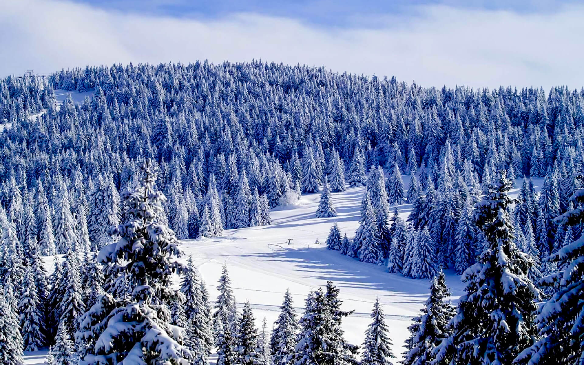
Kopaonik’s climate is shaped by its elevation, southern latitude and open terrain. With nearly two hundred sunny days annually, it has earned the epithet “Sunny Mountain.” Cold air drains swiftly into the surrounding plains, moderating winter extremes; the average annual temperature stands at 3.7 °C. Snow typically blankets the slopes from late November until May, averaging 159 days of coverage, while annual precipitation exceeds 1,000 mm. These conditions sustain a distinctive ecotone in central Serbia: a fragmented forest-pasture zone. Conifers—spruce and silver fir—dominate the higher reaches, giving way on lower slopes to mixed deciduous stands of beech and oak.
The plateau and its flanks shelter a suite of endemic flora. Sempervivum kopaonicense, known locally as the Kopaonik houseplant, clings to rocky outcrops; Cardamine pancici, Pancic’s watercress, lines cold springs; Viola kopaonicensis, the Kopaonik violet, carpets mossy banks. Among vertebrates and birds, the peregrine falcon (Falco peregrinus) and golden eagle (Aquila chrysaetos) patrol thermal currents; the eagle-owl (Bubo bubo) calls at dusk; wildcats (Felis silvestris) and roe deer (Capreolus capreolus) roam forest-pasture ecotones.
Mineral wealth has defined the human narrative of Kopaonik since the Middle Ages. Suvo Rudište—literally “dry ore site”—testifies to historic lead–zinc and silver veins. Mines such as Gvozdac, Zaplanina, Kadijevac and Belo Brdo at the foot of Pančićev vrh preserve relics of medieval exploitation. In recent decades, modern extraction resumed in the Trepča complex, underscoring continuity between past and present. The massif’s very name, derived from the Serbian term for silver, echoes its age-old reputation.
By the early twentieth century a mountain lodge and rudimentary trails catered to seasonal visitors. The interwar period saw the 1935 construction of a more substantial refuge at Ravni Kopaonik, laying foundations for today’s tourist infrastructure. Post-World War II development accelerated: hotels, apartments and private chalets proliferated near Brzeće on the eastern slope, now offering accommodations for over one thousand guests. The centerpiece is Serbia’s largest ski resort, whose twenty-five lifts transport up to thirty-two thousand skiers per hour over slopes that range from gentle nursery runs to challenging descents. In 2019 the resort inaugurated the longest artificial ski slope in Europe, extending its season beyond natural snowfall. A public heliport on a military base north of the resort provides aerial access, while the Ibar highway and Niš international airport serve as principal land links.
Tourism and cattle breeding coexist as primary livelihoods for local communities. Hotels and supporting facilities cluster at Ravni Kopaonik, but smaller complexes near Brzeće and Jošanička Banja draw visitors seeking a quieter retreat. Thermal springs and spas complement winter sport. Jošanička Banja at 78 °C, Lukovska Banja at 36–56 °C and Kuršumlijska Banja at 38–57 °C lie at the massif’s feet. Higher elevations yield unique mineral waters: Krčmar at 1,950 m, renowned as Serbia’s most low-radioactivity source, and Marina Voda at 1,700 m. Within the national park, Jelovarnik waterfall plunges seventy-one metres, its cascades hidden among ancient conifers.
Cultural and historic monuments enmesh with the mountain’s natural attributes. At the foot of Pančićev vrh lie the remains of Crkvine, a medieval monastery whose stones recall feudal piety. Vestiges of the Kukavica road, once a link between mining hamlets, trace four kilometres of ancient engineering. Turkish-period architecture survives in the bathhouse of Jošanička Banja. Liberation-war memorials stand at Mramor and along forested glades: Đački Grob recounts youthful sacrifice; Kriva Reka hosts a monument to victims of fascism. Pančić’s Mausoleum, surrounded by a military complex, honors the pioneering naturalist Josif Pančić, whose botanical surveys unlocked Kopaonik’s scientific promise.
Beyond the immediate massif, the wider area abounds in medieval citadels and monastic sanctuaries. Fortresses—Zvečan (eleventh to fourteenth centuries), Maglić (thirteenth), Brvenik (fourteenth), Lab Peak (fourteenth), Koznik (fifteenth)—perch on remote hills, guardians of bygone frontiers. Monasteries—Peter’s Church near Novi Pazar (eighth–ninth centuries), Studenica (eleventh–twelfth centuries), Žiča (thirteenth century), Sopoćani (thirteenth century), St. George’s Pillars (twelfth century), Gradac (thirteenth century) and Pavlica—compose a Byzantine-Orthodox itinerary celebrated for frescoes and stone carvings. Village houses at Lisina, Đorđevići, Crna Glava and Kriva Reka preserve traditional architecture; watermills and sawmills on Gobeljska Reka and the Brzeće slopes testify to an economy once driven by hydraulic power.
Geological formations, cultural remnants and developed amenities converge to shape Kopaonik’s enduring appeal. The dynamic interplay of evergreen forest, open pastures and sculpted rock forms a living canvas upon which each season inscribes its character. In summer, the plateau’s meadows teem with wildflowers and endemic herbs; in winter, a sparkling mantle of snow transforms ridges into glistening ridgelines. Throughout the year, the vista from Pančićev vrh extends to distant ranges—Šar Planina, Stara Planina, even peaks in Montenegro, Bulgaria and Albania—offering an imperishable view of the Balkans’ mountainous spine.
Kopaonik’s multifaceted legacy—mineral, ecological, cultural and recreational—renders it a microcosm of Serbia’s natural and historical identity. It unites fossils of Earth’s deep past with monuments of human endeavour, alpine wildlife with medieval artistry, ski lifts with ancient pastoral routes. Through careful stewardship of its national park and continued investment in sustainable tourism, Kopaonik stands as both protector of endemic species and catalyst for regional development. Its granite shoulders bear the weight of centuries, even as its slopes welcome a new generation of visitors drawn by the clarity of its air, the precision of its ridges and the quiet resonance of a mountain that has long been at once resource, refuge and inspiration.
Currency
Founded
Calling code
Population
Area
Official language
Elevation
Time zone
Discover the vibrant nightlife scenes of Europe's most fascinating cities and travel to remember-able destinations! From the vibrant beauty of London to the thrilling energy…
From Rio's samba spectacle to Venice's masked elegance, explore 10 unique festivals that showcase human creativity, cultural diversity, and the universal spirit of celebration. Uncover…
From Alexander the Great's inception to its modern form, the city has stayed a lighthouse of knowledge, variety, and beauty. Its ageless appeal stems from…
France is recognized for its significant cultural heritage, exceptional cuisine, and attractive landscapes, making it the most visited country in the world. From seeing old…
With its romantic canals, amazing architecture, and great historical relevance, Venice, a charming city on the Adriatic Sea, fascinates visitors. The great center of this…
© All Rights Reserved. By Travel S Helper