

The American road atlas
Choose the rhythm first then choose the road
The best American road trip is not automatically the longest, the most famous or the one with the greatest number of national parks. It is the route whose daily rhythm fits the people in the car. Some journeys reward a two-week commitment and an appetite for small roadside museums. Others become memorable precisely because the driving ends before lunch and the afternoon belongs to a trail, reef, music venue or mountain town.
This guide compares ten very different journeys without pretending that they are interchangeable. Distances are planning scales, not promises. Closures, fire, storms, shuttle systems, permits and seasonal road openings can reshape an itinerary after it has been booked. Each route therefore includes the trade-off that matters most and a link to the authority that should be checked near departure.
Begin with the experience you want to repeat every day: heritage stops, uninterrupted ocean, slow overlooks, national-park hiking, wildlife watching, live music, warm water, fall color or sculpted geology. Once that choice is honest, the map becomes much easier.
Before comparing routes
Four decisions that shape the whole trip
Long enough to move, short enough to stop without turning every day into a transfer.
A focused seven-day route usually feels richer than a fourteen-stop sprint.
Comfort, tires, range and luggage space matter more than an aspirational vehicle category.
Recheck official alerts before booking, again before departure and each driving morning.
At-a-glance route chooser
Compare the journey, not just the destination count
A realistic duration leaves room for the reason you chose the road.
Planning note: Route scales vary with detours, lodging bases and optional parks.
A route may look short on a national map and still demand days of attention. The Blue Ridge Parkway is only 469 miles, yet the National Park Service advises that thirty miles can take about an hour before any walk or overlook. The Florida Keys cover a fraction of Route 66's distance, but a single-lane slowdown can consume an afternoon. Use the table to choose a suitable rhythm, then build exact mileage only after checking current road access.
| Road trip | Planning scale | Comfortable time | Strongest window | Best for |
|---|---|---|---|---|
| Historic Route 66 | About 2,400 miles | 12–18 days | Spring or fall | Roadside history, small towns and the classic cross-country arc |
| California Highway 1 | Build from open coast segments | 5–10 days | Late spring or early fall | Ocean scenery, coastal towns and short walks |
| Blue Ridge Parkway | 469 official miles | 5–8 days | Late spring, summer or fall | Slow overlooks, Appalachian culture and accessible walks |
| Grand Circle | Roughly 900–1,200 miles | 10–14 days | Spring or fall | Red-rock parks, desert hiking and night skies |
| Yellowstone & Grand Teton | Compact map, substantial park driving | 7–10 days | Late spring through early fall | Wildlife, thermal landscapes and mountain lakes |
| Glacier to Yellowstone | 400–500 connector miles plus parks | 10–14 days | When alpine roads are officially open | Northern Rockies, long daylight and big landscapes |
| Deep South music & history | Roughly 600–900 miles | 7–10 days | Spring or fall | Music, food, civil rights and layered regional history |
| Florida Keys | About 125 miles from Florida City | 3–5 days | Winter or spring | Warm water, island stops and a short linear drive |
| New England foliage | Roughly 500–800 selective miles | 7–10 days | Follow live fall reports | Color, villages, hikes and flexible day loops |
| Black Hills & Badlands | Roughly 250–350 miles | 4–6 days | Late spring to early fall | Wildlife roads, geology and compact regional variety |
Chicago, Illinois · Santa Monica, California
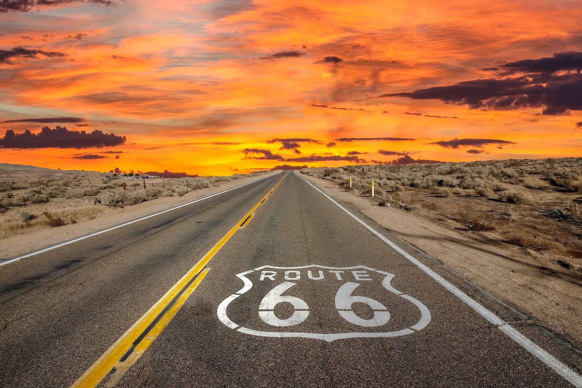
Historic Route 66
The great American road trip is now a chain of choices, not one uninterrupted highway.
Planning scale: about 2,400 miles · Allow: 12–18 days · Best fit: heritage and roadside culture

Route 66 became a symbol because it connected movement with imagination. Created in 1926, the corridor carried families, freight, military traffic and postwar vacationers between Chicago and Southern California. The National Park Service describes roughly 2,400 miles of pavement linking rural main streets with expanding cities. That history remains visible in neon signs, service stations, motor courts, diners and museums—but the road itself was removed from the U.S. Highway System in 1985.
That last fact changes how the trip should be planned. There is no single contemporary road number to follow from beginning to end. A modern Route 66 journey moves among historic alignments, business loops, frontage roads, local streets and interstate connectors. Some fragments are beautifully preserved; others are rough, unsigned, interrupted or simply impractical. A specialist map or state-by-state route guide is more useful than asking a navigation app for the fastest line to Santa Monica.
Build the trip around regions, not a daily mileage quota
The eastern days introduce the route through Chicago, Joliet, Pontiac, Springfield and St. Louis. Missouri, Kansas and Oklahoma then shift the mood toward small-town museums, restored filling stations and layers of Indigenous, migration and transportation history. Texas compresses the road into a broad High Plains horizon before New Mexico and Arizona deliver some of the journey's most recognizable motel signs and desert towns. California adds long Mojave distances, the Los Angeles basin and the ceremonial finish near the Pacific.
A comfortable itinerary uses several two-night stops. Springfield or St. Louis can absorb a history day; Tulsa or Oklahoma City can reset the pace; Albuquerque and Flagstaff work as bases rather than boxes to tick. The Grand Canyon is a possible detour, but it is not a casual roadside stop. Adding it responsibly means adding at least one night and accepting that the trip is no longer only Route 66.
The road's charm is fragile. A famous neon motel may have few rooms. A volunteer museum may close early. A remote café can change hours between planning and arrival. Reserve the few properties that define the trip, then let lesser stops remain flexible. In the Southwest, refuel before the gauge becomes urgent, carry water, save maps offline and avoid following an old alignment onto a road whose condition you have not confirmed.
Use the National Park Service Route 66 history as a factual starting point, then confirm each state's alignment and local attraction hours. Historic identity does not guarantee current access.
Route 66 is best for travelers who enjoy the act of noticing: a tile façade, a restored sign, a town museum staffed by someone who remembers the road before the interstate. It is a poor choice for anyone trying to cover maximum distance with minimum interruption. The route becomes meaningful when the small stops are allowed to decide the day.
California coast · Open segments decide the itinerary
California Highway 1
The ocean is constant; the road is not.
Planning scale: choose a five-to-ten-day coast segment · Best fit: scenery, towns and short walks

“Pacific Coast Highway” is useful travel shorthand, but it can hide the geography. California State Route 1 changes name and character as it follows portions of the coast; it is not one formal road running from downtown San Diego to Oregon. North of California, U.S. 101 carries the Oregon coast. Within California, Highway 1 sometimes shares corridors with other roads, leaves the shoreline and becomes an urban avenue. Planning improves as soon as the fantasy of one unbroken coastal ribbon is replaced with a series of strong segments.
For a first journey, the Central Coast creates the clearest road-trip narrative. Santa Barbara, the Santa Ynez coast, Morro Bay, Cambria, Big Sur, Carmel and Monterey can fill a week without San Diego or San Francisco being forced into the same booking. A longer trip can begin in Southern California or continue north through San Francisco, Point Reyes, Mendocino and the redwood country, but each addition changes both mileage and weather.
Big Sur is a landscape, not a guarantee of through access
Cliffs, steep watersheds and winter storms make Highway 1 vulnerable to slides and repairs. A closure can divide the Central Coast into a northern approach and a southern approach with a long inland detour between them. The correct response is not to gamble on an old blog post. Check the official Caltrans highway page before reservations, again before departure and on the morning you enter the coast. If the road is interrupted, redesign the trip around accessible towns instead of treating the detour as a failure.
Use Caltrans Highway 1 conditions and Caltrans QuickMap. Temporary one-way control, construction and slide work can matter even when the road is technically open.
Driving southbound often places ocean viewpoints on the same side of the road, but that convenience is not worth an unsafe stop. Use signed pullouts, never halt in a travel lane and do not cross traffic impulsively for a photograph. On cliff sections, the driver must watch the road rather than perform the scenery for passengers. Share driving or shorten the day if everyone wants time at overlooks.
Fog is part of the coast rather than evidence that the trip has gone wrong. It may clear later, remain local to one headland or create a quieter atmosphere than postcard weather. Pack layers in every season. Reserve strategically—Big Sur and small coastal towns have limited inventory—but keep at least one day flexible enough for a beach walk, redwood grove, mission town or inland wine-country alternative.
This route is strongest when the itinerary contains fewer hotel changes than attractions. Two nights in one coastal base allow a traveler to revisit a viewpoint in different light, wait out weather and eat dinner without calculating the next arrival. The coast should feel spacious; if every hour has a pin, the map has defeated the ocean.
Rockfish Gap, Virginia · Cherokee, North Carolina
Blue Ridge Parkway
A 469-mile lesson in why scenic distance cannot be measured by interstate time.
Official length: 469 miles · Allow: 5–8 days · Navigation: mileposts and current gate status

The Blue Ridge Parkway begins near Shenandoah National Park at Rockfish Gap and ends 469 miles later near Great Smoky Mountains National Park and Cherokee. It is a long road, but not a road for making distance. The National Park Service suggests that thirty miles often take about an hour. That estimate reflects curves, a general 45 mph limit, overlooks, tunnels, changing elevation and the simple fact that almost every useful interruption is the reason for being there.
Mileposts provide the route's clearest language. In Virginia, Humpback Rocks, Peaks of Otter, Mabry Mill and the Blue Ridge Music Center can form a sequence of landscapes and cultural stops. North Carolina brings Doughton Park, the Linville area, the Linn Cove Viaduct, Craggy Gardens and the high-elevation approaches toward Mount Pisgah. Exact access changes with construction, storm damage, ice and facility seasons, so a list of landmarks is an invitation to check—not an assertion that every gate is open.
A full drive needs off-parkway logistics
Fuel, lodging and meals are found in communities reached from parkway exits rather than at a continuous chain of roadside services. This makes Asheville, Boone, Roanoke and smaller gateway towns practical planning anchors. The best itinerary groups milepost ranges around those bases. A traveler who tries to find dinner and a room only after sunset may discover that the nearest useful exit is farther away than expected.
Autumn brings color and intense weekend demand, but foliage moves by elevation and latitude rather than following one universal peak date. Summer offers longer hours and more open facilities, though afternoon storms and busy overlooks remain possible. Winter can be beautiful and quiet, yet ice closes high sections quickly. Spring has flowers, rain, fog and the possibility that seasonal facilities have not fully opened.
The NPS Blue Ridge Parkway road-status page lists closures by milepost section. It is more useful than a generic mapping app because a closed segment may require a substantial mountain-road detour.
The parkway works for families and mixed-mobility groups because many views are available directly from the car or a short paved approach, while longer trails remain optional. It also rewards music and craft stops that explain the landscape as a lived region, not an empty scenic backdrop. Build a day with one walk, one cultural stop and generous overlook time; three major hikes plus a hundred parkway miles is usually an itinerary written for a spreadsheet rather than a body.
Most importantly, let fog and weather change the plan. A closed view can become a woodland walk, a music center or a meal in a mountain town. The Blue Ridge Parkway is not a chain of guaranteed panoramas. It is a slow journey through altitude, forest and Appalachian history, and its restraint is the point.
Utah · Arizona · Nevada · Navajo Nation
The Grand Circle
A flexible red-rock circuit becomes better when two parks are removed from the first draft.
Planning scale: roughly 900–1,200 miles · Allow: 10–14 days · Best seasons: spring and fall

The Grand Circle is a travel concept rather than a single signed route. Its Utah core commonly includes Zion, Bryce Canyon, Capitol Reef, Canyonlands and Arches. The Grand Canyon, Page, Monument Valley, Mesa Verde and other public or tribal lands can extend the loop. Because the name feels definitive, first-time planners often try to include everything. The result is a sequence of sunset arrivals and sunrise departures in places that deserve daylight.
Start with the season and the desired activity. Spring and fall usually offer more workable desert temperatures, but high plateaus can still receive snow while lower canyons are warm. Summer requires early starts, much more water and restraint during midday heat. Winter can bring quiet roads and snow-framed stone, yet short daylight and icy trails limit how much ground can be covered.
Choose one geographic spine
A western loop might pair Zion and Bryce with the Grand Canyon and Page. An eastern Utah loop can connect Capitol Reef, Canyonlands and Arches through Scenic Byway 12 and the Moab area. A longer circuit can join those halves, but only if the calendar supports multiple two-night bases. Las Vegas is useful for air access to the western parks; Salt Lake City can work for an Utah-focused itinerary. Neither city needs to be treated as the compulsory beginning of every Grand Circle.
Park systems are not interchangeable. Zion uses a seasonal canyon shuttle and has separate permits for particular activities. Bryce operates its own optional shuttle. Arches' entry arrangements have changed across seasons and years; in 2026, advance timed entry is not required, but congestion controls and reservations for specific experiences remain possible. The correct habit is to open each park's official planning page rather than assuming one national-park rule applies everywhere.
Navajo Nation lands require a second kind of attention. Antelope Canyon locations are accessible only with authorized guides. Monument Valley Navajo Tribal Park has its own entry, road, vehicle and backcountry rules. These are not inconveniences attached to a federal-park itinerary; they are the terms of visiting a sovereign, culturally significant landscape. Book through authorized operators, follow photography restrictions and leave enough time to listen rather than treating the place as a brief photo stop.
Use the NPS overview of southern Utah parks, then check each park separately. For tribal lands, use Navajo Nation Parks' authorized Antelope Canyon operators and current Monument Valley guidance.
The strongest Grand Circle schedule alternates a driving day with a deeper park day. It keeps one sunrise optional, not mandatory, and leaves room for wind, heat or a trail closure. It also carries more water than the group expects to drink, protects living soil crusts by staying on durable surfaces and accepts that a smaller loop can deliver a larger experience.
Wyoming · Two parks, one connected landscape
Yellowstone & Grand Teton
The map is compact; wildlife, thermal basins and mountain weather make the days expansive.
Allow: 7–10 days · Best fit: wildlife, geology and dawn-to-dusk variety

Grand Teton and Yellowstone sit close together on a map, connected by the John D. Rockefeller, Jr. Memorial Parkway, yet they reward different ways of moving. Grand Teton is visually immediate: peaks rise sharply beyond lakes, sage flats and the Snake River. Yellowstone is larger and internally slower, with long drives among geyser basins, waterfalls, broad valleys and the northern terraces at Mammoth.
A practical first trip gives Grand Teton two or three full days and Yellowstone at least four. Changing lodging every night wastes the early and late hours that are best for quiet roads, mountain light and responsible wildlife viewing. One Grand Teton base and one Yellowstone base often work better than a perfectly circular schedule. Jackson offers services but adds traffic; park lodging or gateway towns reduce some drives but require earlier reservations.
Wildlife changes the road—and the rules
Bison can stop traffic. Bears may trigger temporary closures. A cluster of parked cars can signal an animal, but it can also create a dangerous roadside situation. Pull completely into designated areas, keep the travel lane clear and follow rangers. In both parks, remain at least 100 yards from bears and wolves and at least 25 yards from all other wildlife. If an animal moves closer, the visitor is responsible for restoring the distance.
Binoculars improve the experience more than approaching does. Dawn in Yellowstone's Lamar or Hayden valleys can be productive, while Grand Teton's open flats, river bends and lake edges may reveal moose, pronghorn, elk or bison. Nothing is guaranteed, and no photograph justifies crowding an animal or blocking its route.
Yellowstone's crust can conceal superheated water. Stay on boardwalks and designated trails, keep children close and never touch thermal runoff. Swimming or soaking in Yellowstone hot springs is prohibited. Read the current Yellowstone safety guidance before visiting a basin.
In Yellowstone, group sights by geography instead of crossing the park for a checklist. Old Faithful and the Upper Geyser Basin belong together; Grand Prismatic requires its own parking patience; Canyon Village anchors the Grand Canyon of the Yellowstone; Mammoth and Lamar Valley form a northern day. In Grand Teton, combine overlooks with one lake or canyon walk rather than driving every scenic road twice.
Weather moves quickly at elevation, and smoke or construction can alter visibility and travel times. Download park maps, carry food and water, and avoid scheduling a flight immediately after a long final park drive. This is a route where one bison jam or thunderstorm can become the day's defining event. The itinerary should be strong enough to absorb it.
Montana · Glacier National Park to Yellowstone
Glacier to Yellowstone
A northern Rockies journey whose most famous road opens on the mountain's schedule.
Connector: roughly 400–500 miles plus park driving · Allow: 10–14 days

Pairing Glacier and Yellowstone creates one of the grandest northern road trips in the United States, but the connection is not a single celebrated scenic road. The route is a composition: days in Glacier, a transfer across Montana and days in Yellowstone. Depending on entrances and stops, the connector commonly runs four to five hundred miles before substantial in-park driving is counted.
Glacier's Going-to-the-Sun Road is the emotional hinge. Lower sections can be accessible when the alpine crossing is not, and the full road opens only after snow removal and safety work. No responsible itinerary should promise Logan Pass on a fixed early-summer date. Check the official status, understand vehicle-size restrictions and have a west-side or east-side plan that still works if the center remains closed.
For 2026, Glacier does not require a vehicle reservation, while Logan Pass uses specific parking limits and a reservation-based shuttle arrangement. Those rules are explicitly current-year information, not a permanent planning fact. A traveler reading this article later must return to the official Glacier page. The durable lesson is to treat access systems as part of trip design, not as an administrative detail discovered at the entrance.
Make the transfer a Montana day, not a race
Whitefish or the Flathead Valley can serve Glacier's west side, while the St. Mary area serves the east. Southbound, Missoula and Butte or Helena can break the journey; Bozeman or Livingston can prepare the approach to Yellowstone. The best line depends on the Yellowstone entrance being used, wildfire conditions and whether the itinerary values museums, river towns or the fastest practical transfer.
Long daylight makes summer attractive, yet it also tempts travelers to overfill the schedule. Glacier needs time for a valley walk, lake or shuttle day beyond the famous road. Yellowstone needs geographically grouped days. Ten nights is a practical minimum for both parks; two weeks allows weather recovery and a less exhausting connection.
Check the NPS Going-to-the-Sun Road page for opening status and restrictions. For 2026-specific Logan Pass access, use the official FAQ; future seasons may work differently.
This route suits travelers comfortable with remote stretches, changing weather and advance planning. It is less suitable for a rigid schedule with nonrefundable bookings every night. When smoke, snow or a closure changes one famous drive, the parks still contain valleys, lakes, trails and viewpoints worth the journey. Flexibility is not a backup feature here; it is the route's essential equipment.
Nashville · Memphis · Mississippi Delta · New Orleans
Deep South music & history
The soundtrack makes more sense when the road also tells the histories of labor, migration and civil rights.
Planning scale: roughly 600–900 miles · Allow: 7–10 days · Rhythm: cities plus Delta and Trace landscapes
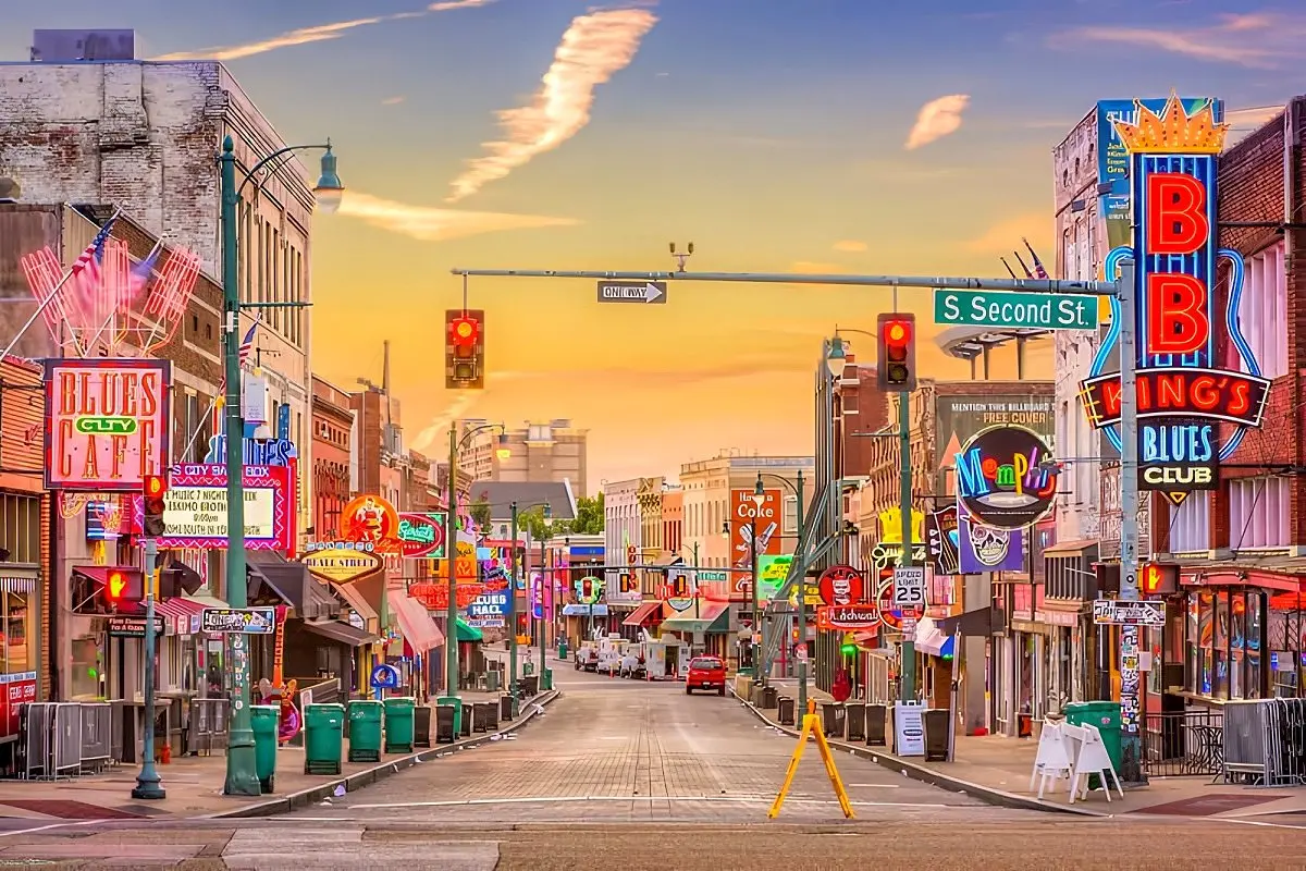
A Nashville-to-New Orleans drive can be sold as a playlist of country, blues, soul, rock and jazz. That is true, but incomplete. The music emerged through specific communities and histories: Black church traditions, field hollers, migration, recording technology, segregated commerce, radio, nightlife and constant exchange among genres. A responsible road trip connects performance with the museums, neighborhoods and civil-rights sites that explain who created the sound and under what conditions.
Nashville introduces the commercial architecture of country music through studios, stages, museums and songwriting. Memphis complicates the story with Sun, Stax, Beale Street, gospel, blues, soul and rock, while the National Civil Rights Museum at the Lorraine Motel places the city's music history beside the struggle that shaped its public life. Clarksdale and the Mississippi Delta bring smaller venues and Blues Trail context. New Orleans ends the route not as a theme park but as a living city whose music, food and neighborhoods demand time and respect.
Nashville
Use two nights for a major museum or studio, one historic stage and one contemporary performance beyond a single entertainment strip.
Memphis
Pair music institutions with the National Civil Rights Museum; add a neighborhood meal and enough time for the stories to connect.
Clarksdale and the Delta
Follow official Blues Trail context, confirm live-music schedules and remember that small venues do not keep big-city hours.
Natchez Trace or river corridor
Choose the quiet parkway for landscape and deep history, or a river-oriented line for additional Delta towns; do not try to do both at speed.
New Orleans
Return the car early if it is no longer useful, then give the city several nights for music, food, architecture and neighborhood-scale exploration.
The Natchez Trace is not an empty scenic shortcut
The Natchez Trace Parkway runs 444 miles from near Nashville through Mississippi to Natchez. It has no food, fuel or lodging directly on the parkway, so services require exits into nearby communities. More importantly, the corridor carries over ten thousand years of human movement. It crosses Indigenous homelands and contains histories of trade, forced removal, enslavement, warfare and migration. NPS interpretation should guide the stops, especially where an attractive landscape can otherwise conceal a difficult story.
Use the NPS history of the Natchez Trace and the U.S. Civil Rights Trail. If visiting a plantation site, choose interpretation that centers enslaved people and the system of forced labor—not a decorative house tour detached from its history.
Night driving is a poor way to connect these stops. It removes the landscape, increases fatigue and can make arrival in unfamiliar neighborhoods more stressful. Drive in daylight, keep urban hotel parking in mind and verify venue schedules directly. Live music calendars change; a legendary room is meaningful only if the current program fits the visit.
This route becomes richer when meals are treated as cultural history rather than a list of dishes to collect. Hot chicken, barbecue, tamales, catfish, Creole and Cajun traditions all have local context and internal debate. Ask where a style comes from, support long-standing local businesses and leave room for a recommendation that was not in the itinerary. The road's strongest moments often arrive when a museum story, a song and a meal begin to explain one another.
Florida City · Key Largo · Marathon · Key West
Florida Keys Overseas Highway
A short road becomes a real trip when the islands are treated as stops, not scenery between bridges.
Planning scale: about 125 miles from Florida City · Allow: 3–5 days · Best fit: water and island time

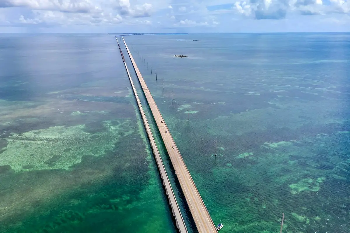
The Overseas Highway feels longer than its mileage because water continually interrupts the land. From Florida City, U.S. 1 reaches Key Largo, crosses the Upper and Middle Keys, passes Marathon and the long open-water spans, then continues through the Lower Keys to Key West. The road is linear, which makes planning simple and traffic consequential: there is rarely a convenient parallel route when congestion, construction, an event or weather slows the flow.
Three nights is enough for a clear introduction; five allows the islands to become more than a drive. Key Largo suits travelers prioritizing diving, snorkeling and access to reef operators. Islamorada and the Middle Keys work for fishing, paddling and a quieter base. Marathon helps divide the drive and gives access to beaches and marine attractions. The Lower Keys offer habitat and a slower atmosphere before Key West adds architecture, museums, sunset crowds and nightlife.
Plan the water activity before the hotel sequence
A reef trip can be cancelled by wind or sea conditions even on a sunny day. Book it early enough in the stay to create a second chance, but keep the cancellation policy and operator credentials clear. The Florida Keys National Marine Sanctuary protects coral reefs, seagrass, wildlife and maritime heritage. Responsible operators use mooring systems where required and explain how to avoid touching coral, standing on reef, collecting organisms or anchoring on sensitive habitat.
Snorkeling is not the only way to experience the Keys. Paddling mangrove water, visiting a state park, walking a historic district or taking a wildlife-focused tour can fit travelers who do not dive. Dry Tortugas National Park requires a separate ferry or seaplane plan from Key West and should not be inserted casually into a departure day.
Review NOAA's responsible diving and snorkeling guidance. Reef access is recreation within a protected ecosystem, not permission to touch, take or anchor wherever convenient.
Traffic deserves a buffer, particularly on weekends, around major events and when weather affects the mainland or island chain. Do not schedule a tight airport connection after driving from Key West. In hurricane season, follow emergency guidance rather than treating a forecast as a tourism inconvenience. Rental vehicles, fuel and parking are available, but Key West itself is often easier on foot once the car is parked or returned.
The best Keys itinerary contains fewer promises than the first draft. Choose one important water day, one island-nature day and enough unscheduled time to stop for a view from a legal pullout. The road is not merely the route to Key West. Its changing water, bridges and communities are the trip.
Maine · New Hampshire · Vermont · Southern New England
New England fall foliage circuit
Book a flexible base and follow the color as it moves from north and high country toward the coast and south.
Planning scale: 500–800 selective miles · Allow: 7–10 days · Essential tool: live state foliage reports

A foliage road trip cannot be scheduled with the precision of a museum ticket. Shorter days, cooler nights, rainfall, wind, drought and elevation all influence when leaves change and how long they remain. The broad pattern is useful: color generally develops earlier in northern and high-elevation areas, then progresses toward southern and coastal areas. The exact week varies each year.
That makes the best itinerary a flexible circuit rather than six state capitals connected by reservation deadlines. One approach uses two bases: a northern mountain base in Vermont or New Hampshire, then a southern or coastal base in Massachusetts, southern Maine, Connecticut or Rhode Island. Another chooses one central base and builds day loops according to the live report. Either strategy is more resilient than changing hotels every night in pursuit of a predicted peak made months earlier.
Use famous roads selectively
Vermont Route 100 can connect Green Mountain towns, but its appeal comes from side valleys, working landscapes and small communities rather than driving every mile. New Hampshire's Kancamagus Highway offers White Mountain overlooks and trailheads, yet parking fills quickly on peak weekends. Northern Maine and the western mountains can color earlier, while the southern Maine coast often follows later. Massachusetts' Berkshires, the Mohawk Trail region, Connecticut's Litchfield Hills and rural Rhode Island can extend the season southward.
Build each day around one scenic road, one walk and one town. This keeps the driver from staring at trees through a windshield for eight hours and distributes spending beyond a single famous village. Weekday travel reduces some pressure, but narrow roads, trailhead parking and residential neighborhoods still require patience. Never park on private property or block local access for a photograph.
Maine's official guidance describes a north-to-south progression, with southern and coastal areas generally later. Check the Maine Forest Service foliage information and the New Hampshire foliage tracker near departure.
Reserve the first and last nights firmly, then prefer changeable bookings in between. Pack rain protection and layers; a warm afternoon can become a cold mountain evening. Download maps because valleys lose signal. If strong wind strips one region early, shift emphasis toward villages, museums, food, coastal walks or a later southern area rather than spending the trip searching for a vanished photograph.
The goal is not to prove that every tree was at peak. A mixed forest—some green, some orange, some already bare—can reveal the season more honestly than a uniform postcard. Flexibility lets weather and local advice improve the trip instead of merely disrupting it.
South Dakota · Prairie, granite and eroded stone
Black Hills & Badlands
A compact regional circuit with enough contrast to feel like several journeys.
Planning scale: roughly 250–350 miles · Allow: 4–6 days · Best fit: geology and wildlife roads

The Black Hills and Badlands combine naturally because the travel time between them is modest and the landscapes are radically different. Badlands National Park exposes bands of sediment, sharp pinnacles and mixed-grass prairie. Farther west, the Black Hills rise in forest and granite, with engineered scenic roads, Custer State Park, historic towns and major memorial landscapes.
Rapid City works as a practical gateway, but dividing nights between the Badlands side and the southern Black Hills reduces backtracking. One Badlands afternoon and sunrise can be enough for overlooks and short walks; a deeper visit adds the Sage Creek area when road conditions suit the vehicle. The Black Hills deserve several days because Wildlife Loop Road, Needles Highway, Iron Mountain Road, Spearfish Canyon and historic sites are distinct experiences, not one circular road.
Separate the scenic drives on the map
Badlands Loop Road is the principal paved scenic corridor through the national park's North Unit, with frequent overlooks and trailheads. Custer State Park's Wildlife Loop Road is an eighteen-mile prairie-and-forest drive that the state advises can take about ninety minutes before extra wildlife delays. Needles Highway passes granite formations and narrow tunnels, while Iron Mountain Road uses curves, bridges and framed views on the connection toward Mount Rushmore. Seasonal closures and vehicle dimensions matter on the latter roads.
Wildlife Loop is not a safari attraction that guarantees an animal beside the car. Bison, pronghorn, deer, prairie dogs and other species move freely. Stay in the vehicle when animals occupy the road, never attempt a close portrait and do not use food to attract the park's burros or any other wildlife. A “wildlife jam” is a reason to wait, not to weave through the herd.
Check the NPS Badlands scenic-driving guidance and South Dakota's Custer State Park scenic-road page. A closure on Needles Highway does not describe Wildlife Loop, and an open main road does not guarantee every gravel spur.
Mount Rushmore, Crazy Horse Memorial and the area's Native history require thoughtful context. The Black Hills are sacred to the Lakota and other Indigenous peoples, and the region's monuments represent very different historical narratives. A good itinerary leaves time for interpretation rather than treating the largest carvings as equivalent photo stops.
Sunrise and sunset bring dimensional light to Badlands formations, but wildlife and darkness increase driving risk. Choose one low-light drive and keep the return simple. In the Hills, let the engineered roads set the pace. The tunnels, curves and granite are not obstacles between attractions; they are the attraction.
From idea to drivable itinerary
Build the road trip in four passes
Sequence prevents the expensive mistake of booking before the route works.
Use for every route: scope → conditions → anchors → daily detail

Road trips often become complicated because the planner begins at the wrong scale. Saving restaurants, overlooks and trails feels productive, but those details cannot repair an itinerary with too many hotel changes or a mountain road closed in the chosen season. Build the trip in four passes and resist moving forward until each layer works.
Define the experience
Choose the route's central promise, the number of nights and the maximum comfortable driving day.
Test the season
Check opening patterns, weather hazards, daylight and whether the defining road normally operates then.
Book the anchors
Secure scarce lodging, tours and first/last nights while keeping ordinary stops as flexible as possible.
Design each day
Add realistic drive time, fuel, food, one major activity and a credible alternative for bad conditions.
Budget with a formula, not a stale gasoline price
Fuel cost begins with distance divided by the vehicle's real-world miles per gallon, then multiplied by the current average price along the route. Add a buffer for park loops, detours, idling and unplanned stops. A rental car can change the calculation through one-way fees, mileage limits, additional-driver charges, parking and restrictions on unpaved roads. Check the contract rather than assuming that an SUV grants permission to drive anywhere.
Lodging is usually the largest flexible expense. Reserve scarce park, island and peak-foliage rooms early, but compare the cost of a gateway town with the time it adds each day. A cheaper room ninety minutes away can be more expensive once fuel and lost morning access are counted. Camping reduces nightly cost only when equipment, reservation fees and setup time fit the trip.
National-park entry, tribal-park entry, guided tours, city parking and ferries belong in separate budget lines. Do not rely on an old total copied from another traveler's trip. Use current official pages, then keep a contingency fund for a changed route or unexpected night.
Plan the car as a small moving system
Before departure, check tires, spare or repair kit, fluids, lights, wipers and brakes. Know what roadside assistance covers in remote areas. Carry water, food, a first-aid kit, flashlight, charging cable, battery pack, weather layers and any required medication where they remain accessible. In hot regions, do not leave people, pets, electronics or pressurized items in a parked vehicle. In bear country, follow local food-storage rules rather than leaving scented supplies exposed.
Download maps and official park information for offline use. Save the lodging address and reservation details as text or screenshots. Paper maps remain useful for understanding alternatives when a closure removes the intended line. Share the itinerary with someone outside the car, especially for remote desert and mountain segments.
Comfort affects safety. A driver who has spent six hours concentrating on a cliff road may not be ready for a night arrival. Rotate drivers before fatigue, not after it. Stop every few hours, drink water and shorten the day when weather or attention deteriorates. The schedule does not have feelings; it can be changed without disappointment.
Before moving, check weather, the relevant state 511 or DOT page, national-park alerts and the next fuel opportunity. Ten quiet minutes at breakfast can prevent hours at a closure.
Finally, identify what can be removed. A resilient itinerary has one optional stop most days and at least one flexible half-day in a week. That space absorbs a long museum visit, an animal on the road, a delayed tour or simple tiredness. It is not wasted time. It is what allows the trip to remain a journey rather than a delivery schedule.
Practical road-trip questions
What travelers usually need to decide
Direct answers, followed by the caveat that keeps the advice useful.
Reminder: Rental rules, access systems and road conditions change.
These answers are planning principles rather than permanent rules. A route suitable for a compact car in summer may require different equipment in shoulder-season snow. A reservation system used in one national park this year may disappear the next. Use the answer to narrow the decision, then confirm the live details with the operator or land manager.
How much does an American road trip cost?
There is no durable national average that is useful for every route. Calculate fuel from planned miles, the vehicle's realistic efficiency and current regional prices. Add lodging, food, parking, entry, tours, one-way rental charges and a contingency. Remote parks can be expensive because lodging is scarce; cities can be expensive because parking dominates. Camping changes the mix rather than making the trip free.
What is the best vehicle for these routes?
A reliable, comfortable vehicle with suitable tires and enough range is usually better than the largest vehicle available. Compact cars work on the paved core of most routes. Extra clearance or all-wheel drive helps only where conditions and rental terms justify it; it does not authorize travel on closed or restricted roads. Check size limits for mountain roads, ferries, garages and historic districts before choosing an RV or large SUV.
Can these trips be done in an RV?
Many can, but the route must be redesigned around the vehicle. Campground reservations, length limits, tunnel clearances, steep grades, parking and generator rules matter. Glacier's Going-to-the-Sun Road, for example, has strict vehicle-size limits on its central section. A smaller tow vehicle or park shuttle may be necessary. Never assume that a road shown on an RV rental map is open or comfortable for the full rig.
Are these routes suitable for solo travelers?
Yes, with the same route-specific preparation expected of any traveler. Share the itinerary, avoid arriving exhausted after dark, keep the vehicle maintained, download maps and choose established lodging or campsites. Solo travel does not require avoiding remote scenery, but it makes communication, fuel margins and honest fatigue decisions more important. Trust a safety concern early rather than negotiating with it because a booking is nonrefundable.
Which road trip works best with young children?
Choose shorter daily segments and predictable stops. The Florida Keys, Black Hills and a section of the Blue Ridge Parkway can be easier than a full cross-country route. Yellowstone and Grand Teton offer extraordinary wildlife and geology, but children must stay close on thermal boardwalks and everyone must respect wildlife distances. Build one active stop into each half-day and protect sleep rather than chasing every sunrise.
How far ahead should accommodations be booked?
Book the scarce anchors first: national-park lodging, small Big Sur properties, island weekends and prime foliage dates. Six to twelve months may be reasonable for the hardest inventory, while ordinary roadside nights can remain flexible. Read cancellation terms. A fully prepaid chain of bookings can become a liability when a road closes; flexibility has financial value.
How many hours should be driven each day?
For a scenic trip, two to five hours of planned wheel time is a useful range. On Route 66 or an interstate transfer, a longer day can be intentional. On the Blue Ridge Parkway, Highway 1 or wildlife-heavy park roads, a short distance may consume the day. Add time for fuel, food, overlooks, traffic and finding parking; mapping-app drive time is not the day's total workload.
How can a road trip be planned for wheelchair access?
Start with official accessibility pages for each park and attraction, then verify the exact date and facility. Many national parks provide accessible visitor centers, overlooks, boardwalks, shuttles or trails, but a temporary elevator, restroom or path closure can change the visit. Ask rental companies about hand controls and transfer needs well ahead. Build alternatives at the same destination so one inaccessible feature does not erase the day.
What should happen when the defining road closes?
Use the alternative designed before departure. Visit the accessible half from the nearest base, choose a parallel cultural or natural stop, or shorten the route and deepen another region. Do not bypass barriers or follow unofficial tracks. A closure protects people, workers or the landscape; treating it as a challenge can endanger all three.
The road worth remembering
Leave enough room for the route to answer back
A good itinerary has direction without becoming a command.
The distance becomes a journey only when stopping is still allowed.
Route 66 asks for curiosity. Highway 1 asks for respect for conditions. The Blue Ridge asks for slowness; the Grand Circle for restraint; Yellowstone and Glacier for humility in wild places. The Deep South asks travelers to listen to difficult history as carefully as they listen to music. The Keys ask them to protect the water, New England to follow a living season, and South Dakota to distinguish a wildlife road from a wildlife guarantee.
Choose the promise that fits the travelers, build the route around official conditions and remove enough from the plan that one unexpected afternoon can still matter. That is how a list of roads becomes a road trip.