

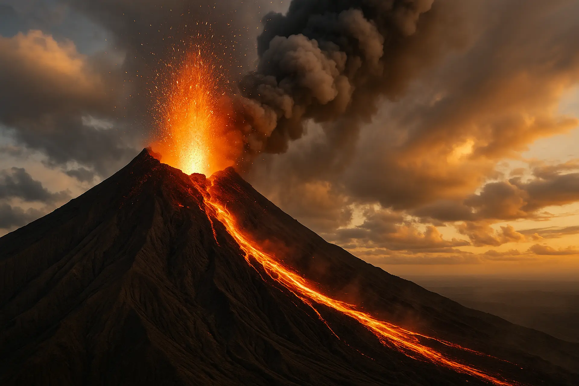
Fire, frequency and false certainty
The World’s Most Active Volcanoes, Without the Ranking Trap
Activity can mean daily explosions, decades of lava, repeated dome collapse or simply a volcano that refuses to stay quiet for long.
Eight volcanoes show why a useful field guide begins with eruption style, monitoring and exposure rather than a single league table.
Lists of the world's most active volcanoes promise a clean answer to a messy scientific question. Kīlauea may erupt through long episodes of fluid lava; Stromboli can produce small explosions so regularly that its behaviour defines an eruption style; Merapi may spend quieter intervals growing unstable lava domes whose collapse is far more dangerous than a photogenic fountain. Counting eruptions alone favours volcanoes that produce many discrete events. Counting active days favours long-lived episodes. Counting impact turns population, wind and infrastructure into part of the ranking. None of those approaches is wrong, but none is complete.
A better traveller's guide asks what kind of activity occurs, how it is monitored and what distance separates spectacle from danger. Lava is not always the main threat. Ash can close airports and damage lungs, pyroclastic density currents can outrun any person, lahars can follow river valleys long after an eruption, and gas can affect communities far from a crater. Even a familiar volcano can change behaviour. Historical frequency describes a pattern; it does not guarantee that tomorrow will resemble yesterday.
The eight profiles below are not presented as a definitive ranking. They are representative volcanoes with persistent or frequently renewed activity, strong scientific observation and clear relationships with nearby communities or visitors. Each deserves its own section because each is a different system. Their shared lesson is simple: active volcano tourism is safest when the view is treated as a privilege created by monitoring, closures and local knowledge, not as permission to approach the vent.
Before the list
What “active” really means
The word covers geological time, present unrest and observable eruption, so every claim needs a timescale.
In broad geological use, an active volcano is often one that has erupted during the Holocene or retains the capacity to erupt again. That definition is useful for inventories and hazard planning because a few quiet centuries are brief in the life of a volcanic system. In everyday language, however, active usually means erupting now or showing obvious unrest. Confusing the two creates sensational headlines about thousands of active volcanoes and disappointment when a famous cone produces no visible lava during a holiday.
The Global Volcanism Program maintains eruption histories and works with observatories to describe current activity, but even a global database depends on observation. Remote submarine volcanoes, cloud-covered islands and regions with sparse instruments are less completely documented than volcanoes watched by dense networks and millions of phone cameras. A ranking can therefore measure monitoring as much as magma. Frequently reported does not always mean intrinsically more active; it can mean easier to see and define.
Eruption style also changes the meaning of frequency. A shield volcano may sustain an episode through numerous pauses and restarts, while an explosive stratovolcano can generate separate ash emissions in a single day. A dome-building eruption may appear slow until part of the dome collapses into a pyroclastic flow. Scientists use seismicity, deformation, gas, thermal data, visual observation and field evidence together because no one signal translates neatly into a place on a list.
For travellers, the practical classification is not 'active' versus 'inactive' but open, restricted or closed under present conditions. That status belongs to an authority with instruments and local responsibility. An old photograph, a tour advertisement or a social-media post cannot replace it. The most exciting volcano experience may be a distant viewpoint, a landscape shaped by earlier lava or a visitor centre explaining an eruption that is currently invisible.
| Measure | What it captures | What it misses | Best use |
|---|---|---|---|
| Eruption count | Discrete reported events | Event definitions and duration | Comparing well-documented records cautiously |
| Active days | Persistence through time | Intensity and human impact | Long-lived effusive or open-vent systems |
| Explosivity | Potential energy and ash production | Frequent low-level behaviour | Understanding eruption scale |
| Hazard exposure | People and infrastructure at risk | Activity without nearby population | Emergency planning |
| Current alert | Present observatory assessment | Long-term reputation | Immediate travel decisions |
Hawaiʻi Island · United States
Kīlauea
A basaltic shield volcano whose long eruptions, sudden summit episodes and accessible national-park setting have shaped the public image of flowing lava.
Best for: understanding effusive volcanism from official overlooks while respecting gas, cliff and closed-area hazards.

Kīlauea is often described as one of Earth's most active volcanoes because its modern history includes exceptionally long eruptive periods and repeated summit activity. Its broad shield shape was built by relatively fluid basaltic lava, a style very different from the steep, ash-producing cones that dominate disaster imagery. Fluid does not mean harmless. Lava can cut roads, ignite buildings and transform neighbourhoods, as the 2018 lower East Rift Zone eruption demonstrated with extraordinary force.
The summit has its own rhythm. Eruptions within Halemaʻumaʻu may begin rapidly, produce fountains and fill parts of the crater floor, then pause while magma continues to pressurise the system. An apparent end can therefore be one phase in a longer sequence. The Hawaiian Volcano Observatory combines earthquakes, tilt, GPS, gas, webcams and field observations to interpret those changes. Its notices distinguish ground hazards from aviation concerns and explain the evidence behind alert changes.
For visitors, Hawaiʻi Volcanoes National Park offers a rare opportunity to see young volcanic terrain within a managed landscape. The experience might include glow from a distant overlook, steaming ground, old lava flows, rainforest recovering beside black rock or no visible eruption at all. The park closes areas where cracks, unstable cliffs, gas, heat or eruptive vents create unacceptable risk. Entering a closure does not produce a more authentic encounter; it removes the protections that make public access possible.
Volcanic gas is the hazard most easily underestimated. Sulfur dioxide can react in the atmosphere to create vog, affecting air quality far downwind. Conditions vary with emissions and weather, and people with respiratory or cardiovascular vulnerabilities may need to adjust plans. Ash-like glass particles and tephra can also fall during vigorous fountains. Visitors should use park and health guidance rather than assuming that a clear view means clean air.
Kīlauea teaches the central lesson of effusive volcanoes: slow-looking processes can still overwhelm infrastructure, and accessible viewing depends on constant observation. A good visit leaves room for the volcano to be quiet, obscured or closed. The landscape is not a failed attraction when the lava cannot be seen; it is the record of a living system whose safety boundaries must move with it.
Sicily · Italy
Mount Etna
Europe’s highest active volcano is a complex mountain of summit craters, flank vents, lava fields, farms and towns rather than a single theatrical cone.
Best for: guided high-elevation geology, broad lava landscapes and learning how communities adapt to frequent ash and eruptive change.

Etna dominates eastern Sicily physically and culturally. Its upper slopes are a shifting volcanic environment, but lower elevations support vineyards, orchards, villages and roads laid across earlier lava. This coexistence is possible because many eruptions are moderate and because monitoring, land use and local experience have developed around recurrence. It should not be romanticised: lava has destroyed buildings, ash disrupts daily life and flank eruptions can open far from the summit.
The volcano has several summit craters and a history of vents forming on its sides. Activity may include Strombolian explosions, lava fountains, ash columns and effusive flows, sometimes in rapid sequence. The INGV Etna Observatory maintains seismic, deformation, gas, thermal and visual networks and issues bulletins and aviation notices. Catania's airport is particularly sensitive to ash, so a summit event can alter travel plans even when towns are not directly threatened by lava.
Tourism operates across different hazard environments. Cable cars, vehicles and walking routes may serve lower or upper areas depending on conditions, while access near active craters is regulated and often requires authorised guides. Weather can be as decisive as volcanic activity: cloud, wind, snow and rapid temperature change affect visibility and exposure. Casual footwear and a city jacket are poor preparation for high volcanic terrain even on a warm Sicilian morning.
The mountain's popularity can create a false sense of permanence. A route used last season may cross new deposits or fall inside a revised restriction. Tour descriptions should be read for the actual elevation and activity, not simply the word 'summit'. Responsible guides explain what can be reached that day, carry communication equipment and turn back when the observatory or weather requires it. Travellers should accept that decision without bargaining for a closer position.
Etna is most rewarding when approached as a mountain inhabited over time. Lava-stone walls, rebuilt roads and agricultural soils show the long negotiation between eruption and settlement. The dramatic crater is only one chapter. A visit that connects an official high-slope excursion with lower communities reveals why frequent activity is not merely a spectacle but a condition of life.
Aeolian Islands · Italy
Stromboli
A small volcanic island with an open vent whose frequent explosions created the term “Strombolian,” yet whose larger events can be sudden and deadly.
Best for: distant night viewing and authorised routes governed by current civil-protection restrictions.

Stromboli rises directly from the Tyrrhenian Sea, and its persistent small explosions have given generations of sailors and visitors a natural beacon. Gas slugs burst through magma in the open conduit, throwing incandescent fragments above the summit craters at intervals that may be counted in minutes. This regularity made the island a textbook example, but the label can be misleading if it suggests perfect predictability. The system can produce stronger explosions, lava overflow and slope instability beyond its ordinary pulse.
Most erupted material on the active side descends the Sciara del Fuoco, a steep scar facing away from the main settlements. That geometry reduces routine exposure but does not remove risk. Larger explosions can project ballistics beyond the crater terrace, while collapses or rapid movement into the sea can create waves. The 2019 events were reminders that a volcano famous for mild, repeated activity can change scale with little warning.
INGV watches Stromboli with seismic, deformation, camera, thermal and other instruments, and authorities adjust access accordingly. Rules for hiking elevation and group guidance have changed after dangerous episodes. A travel article that describes a fixed summit trek is therefore immediately vulnerable to becoming unsafe. Visitors should check the municipality, civil protection and licensed guide information for the exact day and should understand that boat viewing may also be affected by sea conditions and exclusion distances.
Night makes the explosions visually powerful because modest incandescent jets become legible against darkness. It also complicates movement, weather assessment and evacuation. Proper footwear, a light, water and instructions from a qualified guide are basic, not optional adventure accessories. Travellers should never leave a permitted route to imitate images made with telephoto lenses or long exposures; the photograph often compresses distance and time.
The island community is part of the experience. Homes, paths and businesses exist on the slopes of an active system, and emergency arrangements are designed for residents before tourists. Respect sirens, assembly information and harbour instructions. Stromboli is compelling because ordinary life continues beside extraordinary geology, not because the volcano owes every visitor a close explosion.
Kagoshima · Japan
Sakurajima
Frequent ash emissions rise beside a major city, making preparedness, cleaning and alert literacy part of everyday life around Kagoshima Bay.
Best for: observing an active volcano from established viewpoints while learning how a densely populated region manages routine ashfall.

Sakurajima occupies the southern part of the Aira caldera and faces Kagoshima across a narrow stretch of bay. Its twentieth- and twenty-first-century activity has included frequent explosive emissions, often producing ash columns that residents can watch from streets and ferries. The great 1914 eruption generated lava that connected the former island to the Ōsumi Peninsula, a reminder that the routine pattern is not the maximum the system can produce.
Ash defines the everyday relationship between volcano and city. Wind determines which districts receive fallout, and local forecasts help residents plan cleaning, transport and outdoor activity. Fine ash can reduce visibility, irritate eyes and lungs, abrade machinery and make roads slippery. The response is practical rather than theatrical: designated collection, protective habits, school preparedness and a public vocabulary of warnings built through repeated experience.
The Japan Meteorological Agency issues eruption warnings and a five-level volcanic alert system tied to recommended actions and restricted areas. Level numbers should be read through the current official explanation, not translated casually into another country's colour scale. Kagoshima University and national agencies contribute extensive observation through seismic, deformation, geochemical and visual systems. The region is among the world's clearest examples of science integrated into daily civil protection.
Visitors usually experience Sakurajima through ferry access, museums, footbaths, coastal roads and viewpoints that remain well below the active craters. The summit area is not a normal hiking objective. Ballistic blocks from explosive eruptions can travel beyond the vent, and exclusion zones exist for a reason. Carrying a simple mask and eye protection can be sensible when ash is forecast, but equipment does not authorise entry into a restricted area.
Sakurajima complicates the idea that volcanic tourism is a rare expedition. It is visible during commuting, eating and ordinary urban movement. That proximity can produce familiarity without complacency because local systems continually translate activity into action. A thoughtful visit pays attention to those systems and to the labour required after an ashfall, not only to the plume that makes the photograph.
Central Java · Indonesia
Mount Merapi
A steep dome-building volcano whose collapsing lava and rain-remobilised ash create some of the most dangerous recurrent hazards in Indonesia.
Best for: distant landscape interpretation with local guides and strict obedience to PVMBG exclusion recommendations.

Merapi stands north of Yogyakarta amid densely used agricultural land and long-established communities. Its name is often translated as Mountain of Fire, but its characteristic danger is not a river of fluid lava moving slowly across open ground. Viscous magma accumulates in domes near the summit. As a dome grows unstable, hot blocks can avalanche and generate fast pyroclastic density currents that race down established drainages with little room for escape.
The 2010 eruption demonstrated the system's capacity for escalation, causing extensive evacuation and loss of life. That disaster also showed why historical danger zones cannot be treated as permanent boundaries. Eruption scale, dome direction and valley topography determine which areas are exposed. Heavy rain adds a second hazard by remobilising loose volcanic material into lahars that can damage bridges and settlements well after the most obvious explosive phase.
Indonesia's PVMBG monitors Merapi through local observatories and the MAGMA information platform. Seismicity, deformation, visual dome assessment, gas and rockfall signals contribute to recommendations. Those recommendations may specify different distances by sector because the likely path of collapse follows particular valleys. A tourist who remembers only one circular exclusion radius can therefore misunderstand the actual warning.
Commercial trips around Merapi often focus on villages, museums, older deposits and viewpoints rather than the summit. These can provide valuable local history when guides explain evacuation, rebuilding and the limits of prediction. They become irresponsible when operators chase a fresh ash plume, cross closure points or describe risk as proof of authenticity. Motorised access does not make a hazardous valley safe, and a clear sky does not neutralise an unstable dome.
Merapi's slopes are also cultural landscapes. Farming, spiritual practice, memory and government relocation policy shape how people live with the mountain. Visitors should avoid reducing residents to victims or daredevils. Their choices involve livelihood, family and attachment as well as risk. The volcano's activity is best understood through that human geography and through respect for the observers whose warnings are designed to create time for action.
Central Mexico
Popocatépetl
A frequently restless stratovolcano between major population centres, where ash and ballistic hazards make the summit a prohibited objective.
Best for: distant views from legal locations and close attention to Mexico’s volcanic traffic-light system.

Popocatépetl rises between the metropolitan regions of Mexico City, Puebla and Cuernavaca, making its activity consequential far beyond the immediate cone. Since renewed unrest in the 1990s, the volcano has produced repeated exhalations, ash emissions, explosions and episodes of lava-dome growth. Many events are limited, but ash can disrupt aviation, agriculture, water systems and daily life across a broad downwind area.
Mexico communicates risk through a volcanic alert traffic light with phases that describe expected phenomena and public actions. CENAPRED and civil-protection authorities emphasise an exclusion area around the crater because explosions can eject incandescent fragments and because the volcano can escalate. The summit is not a legal adventure climb during this continuing activity. Photographs of people at the rim demonstrate rule-breaking, not an itinerary that can be made safe with better fitness.
Monitoring combines seismic stations, cameras, deformation, gas and analysis of eruptive products. Daily reports can count emissions and describe ash direction, but travellers should not interpret a lower count as permission to approach. Observatory data are evaluated within trends and the physical state of the volcano. Wind forecasts and aviation notices may be more relevant to a visitor's immediate plans than whether a glow was visible overnight.
Distant viewpoints can still be rewarding. Clear mornings from parts of Puebla, the Valley of Mexico and surrounding highlands reveal the mountain's scale, sometimes beside Iztaccíhuatl. Visibility varies with cloud, pollution and ash. If fallout occurs, follow local advice on masks, water storage, driving and cleaning; dry sweeping can put fine particles back into the air. Airline passengers should monitor carriers because ash management can change schedules even when airports remain open.
Popocatépetl shows why danger is not proportional to photographic drama. A modest grey emission can matter because of population and wind, while a visually impressive plume may remain within managed scenarios. The correct response comes from CENAPRED's current phase and local instructions. The volcano is a landmark, a cultural presence and a monitored hazard — never a summit trophy.
Escuintla, Sacatepéquez and Chimaltenango · Guatemala
Volcán de Fuego
Frequent incandescent explosions make Fuego visually compelling, while the 2018 disaster proves how quickly pyroclastic flows can turn observation into catastrophe.
Best for: authorised distant viewing, often from established areas, with guides who treat evacuation and weather as non-negotiable.

Fuego is one of Central America's most persistently active volcanoes, producing repeated explosions, ash plumes and incandescent material from a steep summit above populated valleys. Its ordinary activity can create a dangerous visual familiarity. From Antigua or the ridge of neighbouring Acatenango, small night explosions may look regular enough to be entertainment. The June 2018 eruption, when pyroclastic flows devastated communities, showed that the system can change scale and that valleys channel lethal currents far from the crater.
INSIVUMEH observes Fuego and issues technical reports, while national and local civil-protection agencies coordinate warnings and evacuations. Monitoring includes seismic, acoustic, visual, satellite and field information, but difficult terrain and rapidly evolving events limit certainty. Communities closest to drainages need warnings translated into immediate movement. Travellers are secondary to that priority and should never obstruct evacuation routes or demand that a guide continue when residents are responding.
Acatenango treks have made Fuego a major adventure-travel image. The route is physically demanding, cold at elevation and exposed to weather even before volcanic risk is considered. Camps and viewpoints vary, as do guide standards. A responsible operator discusses current activity, group equipment, communication, altitude, shelter and cancellation. A cheap tour that omits warm gear or emergency planning is not simply uncomfortable; it reduces the margin available when conditions change.
Distance must be interpreted by topography. A ridge may offer a spectacular line of sight while valleys below act as pathways for pyroclastic flows or lahars. Ash can irritate eyes and lungs, contaminate food and water and affect aircraft. During the rainy season, deposited material can move through channels without a new major eruption. Visitors should not descend toward fresh deposits or cross official restrictions in search of a louder view.
Fuego is a place to reject the language of conquest. The safest experience is often one in which the volcano remains across a deep valley, seen through a telephoto lens and framed by the knowledge that people live below it. Local guides and observatory reports make that view possible. The mountain does not become more meaningful when the distance is reduced.
Réunion · France
Piton de la Fournaise
A frequently erupting shield volcano inside a large collapse enclosure, where official routes can sometimes bring visitors close to young lava without making access permanent.
Best for: marked-trail volcanic landscapes and eruption viewing only when the prefecture and observatory explicitly permit it.

Piton de la Fournaise occupies the southeastern part of Réunion and ranks among the world's most frequently erupting basaltic shield volcanoes. Many eruptions open fissures inside the Enclos Fouqué, a broad collapse structure that helps contain common lava flows away from the island's most populated areas. This geometry contributes to its reputation as an accessible volcano, but eruptions outside the usual enclosure, unstable ground and gas remain part of the hazard picture.
The OVPF, operated by the Institut de Physique du Globe de Paris, maintains continuous seismic, deformation, gas and visual monitoring. Inflation and earthquake crises may precede fissure opening, prompting authorities to close access before an eruption becomes visible. After activity begins, the prefecture determines whether and where the public may approach. The authorised viewpoint depends on the vent position, lava direction, weather and route condition, so memories from a previous eruption are not reliable instructions.
Even without an eruption, the Route du Volcan and marked trails reveal an extraordinary sequence of landscapes, from high plains to the caldera overlook and dark lava surfaces. Weather can turn quickly, cloud can erase landmarks and sharp basalt is unforgiving in a fall. Hikers need water, sun and rain protection, sturdy shoes, navigation awareness and enough daylight. Leaving the marked route can damage fragile surfaces and make rescue harder.
When lava crosses the coastal road in larger events, the public often gathers at managed viewpoints after conditions stabilise. Fresh lava remains hot, hollow and unstable long after the surface darkens. Ocean entry creates additional hazards through steam, acidic aerosols and collapse. A rope or sign that seems conservative is responding to processes invisible from a photograph. Visitors should not stand on new flows or approach a delta because others appear to be doing so.
Piton de la Fournaise demonstrates that access and discipline can coexist with wonder. Scientific monitoring sometimes makes an eruption view possible, but it cannot guarantee one on a particular travel date. The island offers volcanic meaning in older flows, ecosystems and observatory interpretation whether or not red lava appears. That broader perspective turns a missed eruption into a complete journey rather than a failed chase.
From signal to decision
How monitoring becomes a warning
Instruments do not predict an exact eruption on command; they reduce uncertainty by detecting change and comparing it with a volcano’s history.
Seismometers record earthquakes and tremor produced as rock breaks, fluids move and gas escapes. GPS, tiltmeters and satellite radar measure deformation that may indicate pressure building or draining beneath the surface. Gas instruments sample sulfur dioxide, carbon dioxide and other emissions, while thermal cameras and satellites locate heat. Infrasound can detect explosions, rain gauges help evaluate lahar potential and field teams examine deposits that reveal what actually happened.
The difficult work is interpretation. A single earthquake swarm can fade without eruption, gas can change because of weather or conduit conditions, and deformation may occur too deep to produce immediate surface activity. Observatories build a baseline for each volcano and look for multiple signals moving together. Forecasts are probabilistic: scientists may identify an increased likelihood, a likely hazard sector or an expected range of behaviour without knowing the exact minute or magnitude.
Warnings then enter a social system. Civil-protection agencies, park managers, airlines, schools, tour operators and residents need language tied to actions. An alert level is useful only when people know what to do and trust the institution issuing it. False alarms have costs, but delayed evacuation can be catastrophic. Local systems therefore reflect local hazards and governance; travellers should read the accompanying text rather than comparing colours across countries.
Tourism should be the easiest sector to move out of danger because visitors do not need to protect homes, livestock or livelihoods. Yet tourists sometimes resist closures because they have paid for a once-in-a-lifetime view. That attitude inverts the purpose of monitoring. The observatory's success is not measured by whether every traveller sees lava, but by whether changing activity produces informed distance before the hazard arrives.
Detect change
Networks identify departures from the volcano’s normal seismic, deformation, gas or thermal behaviour.
Combine evidence
Scientists compare several signals with past episodes and current field observations.
Define likely hazards
The assessment considers vents, valleys, wind, weather and exposed communities.
Issue an action message
Observatories and civil-protection agencies translate uncertainty into restrictions, alerts or evacuation.
Update repeatedly
New data can raise, lower or redirect the response; an alert is a living assessment.
Adventure with a boundary
How to visit an active volcano without chasing danger
Preparation begins with the official status and continues through operator quality, weather, equipment and a willingness to abandon the plan.
Start with the institution responsible for the volcano, not a search image or reseller. Read the latest bulletin, the public alert and the land manager's access notice. Check the time of the update and whether the recommendation applies to the crater, a sector, a river valley or the entire area. If information is unavailable in a familiar language, use a reputable guide or accommodation that can interpret the official message. Silence from an operator is not evidence that conditions are normal.
Choose a route that has an obvious authority and an exit. Licensed guides matter where they are required, but a licence should still be accompanied by current knowledge, communications, group limits and clear cancellation rules. Ask what happens if the alert changes, who makes the turn-around decision and what equipment is provided. Avoid tours whose marketing depends on breaking an exclusion zone or promising proximity that responsible operators cannot guarantee.
Prepare for ordinary mountain and coastal hazards. Cold, heat, altitude, lightning, loose rock, darkness, waves and road conditions cause emergencies even when a volcano is quiet. Carry water, layers, appropriate footwear, a light and respiratory protection when official guidance recommends it. Share the route and return time. Insurance should cover the actual activity and evacuation environment; a standard sightseeing policy may exclude high-altitude trekking or travel against official advice.
Know the hazards that continue after the spectacle. Ash can damage engines and electronics, fresh lava can remain hollow and hot, lahars can occur during rain and unstable cliffs can collapse into the sea. Never enter a drainage to photograph a plume, stand downwind of a vent or approach an ocean-entry delta. Telephoto lenses and designated overlooks are not lesser experiences. They are technologies of safe distance.
Finally, accept disappointment. Cloud may hide the summit, a ferry may be cancelled or authorities may close the trail just before arrival. A traveller who treats closure as part of the story will learn more than one who searches for a loophole. Volcanoes are compelling because they are not staged. The same independence that creates wonder also requires the visitor to leave without the image they expected.
Is a continuously active volcano easier to predict?
Frequent behaviour creates valuable data, but it does not eliminate sudden escalation or guarantee a safe viewing window.
Does a low alert level mean the summit is open?
No. Land managers can maintain closures for gas, instability, weather or residual hazards, and local systems use different definitions.
Is lava the main danger at every active volcano?
No. Ash, ballistics, pyroclastic flows, lahars, gas, landslides and tsunami can be more important depending on the system.
Can a guide overrule an official closure?
No. A guide can interpret conditions and lead authorised routes, but cannot make a prohibited area safe or legal.
The final perspective
The most honest volcano view includes the distance that keeps it possible.
Kīlauea, Etna, Stromboli, Sakurajima, Merapi, Popocatépetl, Fuego and Piton de la Fournaise are all highly active in meaningful ways, but they cannot be reduced to one sequence. Their magma, eruption styles, topography and human exposure differ. A daily ash emission beside a city, a persistent open vent on an island and an episodic lava eruption inside a caldera ask different scientific and civic questions.
The ranking trap is seductive because it makes dynamic systems feel collectible. The field guide offers a better reward: seeing how observation becomes warning, how communities adapt and how access changes in response to evidence. The boundary around a crater is not empty space between the traveller and the experience. It is the product of history, instruments and decisions made to prevent the next eruption from becoming a preventable death.
Visit active volcanoes for the landscapes, the science and the human stories, not for proof of closeness. The plume may disappear, the lava may pause and the route may close. What remains is a clearer understanding that the planet is active on its own terms — and that wonder grows, rather than shrinks, when danger is given the distance it deserves.